
Pathik
Pathik is configurable GPS based active navigation software. This software is configurable not only for PND (Personal navigation device) but also for other business and corporate use. This GPS software has a state of the art navigation engine and efficient way of navigation with active voice command.
Personal Navigation Device (PND)
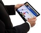
![]() PND is a handheld cum car-held hardware run by WinCE platform. PND, however, is a multidimensional device, not only a navigation system, which includes various functionalities such as mp3 player, video player, digital photo frame, calculator, personal schedule planner etc. The price of the hardware will vary based on the functionalities of customers’ needs.
PND is a handheld cum car-held hardware run by WinCE platform. PND, however, is a multidimensional device, not only a navigation system, which includes various functionalities such as mp3 player, video player, digital photo frame, calculator, personal schedule planner etc. The price of the hardware will vary based on the functionalities of customers’ needs.
However, PATHIK on PND will have the main purpose to navigate a vehicle or a person to a desired destination.
Features
Active navigation to a selected destination using voice instruction (any language possible) and live routable map display.
Users can look for various point of interest (POI) such as ATM, Hospital, Restaurant etc. around her/his present location or any other selected location.
Any feature related to geographical location and time can be implemented according to targeted customers’ demand. For example an automatic delivery route based on multiple delivery points for courier service.
Handset based solution
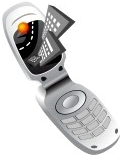 The developed software will be compatible with Win CE / Windows mobile based smart phones. Standalone apps for GPS enabled mobile handsets are under developed. Primary target is to port the existing software to Symbian, iPhone and Android based handsets. As the complete code is written with C/C++, it will be easy to port this for other operating systems as well.
Car Tracking
![]() SinePulse also has knowledge on Car Tracking system. The map and the software can be easily readjusted for active car tracking which will be much more efficient than the existing car tracking system. For example, security personnel will be able to directly chase a stolen car by active navigation with live update of the present location of the stolen car.
SinePulse also has knowledge on Car Tracking system. The map and the software can be easily readjusted for active car tracking which will be much more efficient than the existing car tracking system. For example, security personnel will be able to directly chase a stolen car by active navigation with live update of the present location of the stolen car.
Government, NGO and Corporate Solution
 PATHIK can be easily reconfigured or customized for specific user group. There can be thousands of examples. In the following some examples are given:
Government can use it for various purposes, such as security, military, survey, post etc. A very good example can be the disaster management. With the satellite picture, the geographic location of a cyclone area can be easily detected and this data can be used by rescue workers to reach the position easy and fast. It also helps in workforce distribution accurately.
NGO workers also need geographical information for various purposes. For example, the payment collectors of microcredit banks and auditors of any organization can use the central location data to reach the customer accurately and independently.
Mainly three corporate sectors can be highly benefited by using navigation system: (i) Service Provider (especially telecom), (ii) Distribution houses, and (iii) Logistic.
For a telecom provider, it is necessary to survey various geographical information. For example, ‘‘where are the base-stations located?’’ ‘‘where is the signal weak?,’’ or ‘‘how to optimize the network?’’ etc. To do these tasks efficiently, the field workers can use GPS enable navigation and/or data acquisition systems.
A distribution house, moreover, can map their itinerary according to the demand, and the supplier can use the optimum path as well
Buddy Finder

This is an application that SinePulse likes to introduce in near future which will be especially attractive for the mobile phone users. Buddy finder can locate each individual of a group who likes to know each other’s location. This can be done in various methods. For example, Martin is at an unknown place in Lakeside Park, and asks Anja to join him. They would not need to bother how to find each other. If Martin sends Anja an SMS initiated by PATHIK (Next Gen) and Anja opens the SMS, she gets an option to run his GPS navigator to guide him to Martin. Another scenario is that two friends in two cars start driving towards Frankfurt from Munich. They can monitor the location of each other at real time.
.
Click here to Contact us for your custom specification